Connect Manavgat Waterfall, Sorgun Beach and Titreyengol in one day around transport, nature, crowds and shore safety.
Walk this route
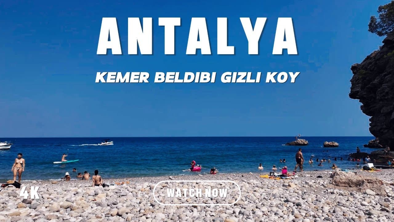
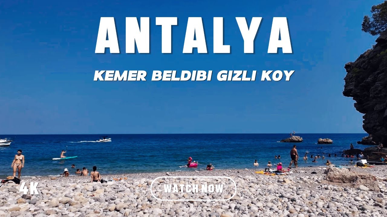
Turkey Antalya - Kemer - Beldibi - Hidden Cove | Walking and Beach Views - 4K
Watch the 4K walkPlaces on the map
12 pinsNumbers match the order in the article. Tap a pin for directions.
--- title: "Manavgat guide: the waterfall is not what you expect, plus Titreyengol, Sorgun, Oymapinar and the inland north" description: "An honest guide to Manavgat: the truth about a waterfall that is low and wide rather than tall, Titreyengol and the marsh legend behind its name, the Sorgun pine forest and beach, the Tuesday market, Seleukeia north of Side, the Oymapinar Dam and Green Canyon, Koprulu Canyon and Selge. How many days, when to go, what to eat, and why Altinbesik is not in Manavgat." city: "Manavgat" lang: "en" ---
Manavgat: the waterfall is not as tall as you think
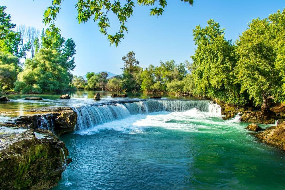
If you arrive at Manavgat Waterfall expecting the vertical drop you saw online, you will feel let down at the water's edge. Here is what it actually is: not water plunging off a cliff, but a river spilling over a low step of three to four metres across a wide front. There is no height, only width and volume. Photographs crop the frame tight to make it look dramatic. In person you meet a loud, broad, cool threshold rather than a sheer fall. Knowing this in advance saves the visit, because people who come with the right expectation enjoy it and people who come expecting a tall cascade leave annoyed.
The second reality is the setting. The banks have grown commercial over the years. Entrance, parking and the seating areas along the water are all built up, and it gets crowded at peak hours. The view is still there, but do not expect a quiet corner of nature. There is also a detail about where the water comes from. Dumanli, the largest karst spring feeding the Manavgat River, ended up inside the reservoir after the Oymapinar Dam was built. So the river's regime is not the same as it was before the dam. Treat the present flow as seasonal and variable. I am not going to claim a specific percentage drop, because I could not verify one from an official figure.
Manavgat is more than the waterfall. The district also contains the ancient city of Side, boat tours run along the river, Titreyengol and the Sorgun forest sit to the east, the Oymapinar Dam and Green Canyon lie to the north, and further north still are Koprulu Canyon and Selge. This guide treats the waterfall not as a single objective but as the entrance to a large district. I do not give fixed prices, hours or tour fees. Those change quickly and should be confirmed the same day from an official or direct source.
Quick answer
Manavgat makes sense when you spread the waterfall and river over half a day, Titreyengol and Sorgun over a day, and Oymapinar and the northern canyons over a separate day, all done with a car.
- Waterfall and river tour: half a day. It is low and wide, not tall. Set your expectation accordingly.
- Titreyengol and Sorgun: a forest lagoon and a pine-forest beach. Half a day to a day together.
- Side: inside the district, but it has its own guide. I mention it here only for context.
- Oymapinar and Green Canyon: a boat tour on the reservoir. Half a day.
- Koprulu Canyon, Selge and Tazi: the mountainous inland north, a separate full day with its own day-trip guide.
- Altinbesik Cave is not in Manavgat but in the neighbouring district of Ibradi. I explain below.
- A car: practically necessary. The distances between stops take longer than the map suggests.
1. Manavgat Waterfall
The place the district is named after, and the most misunderstood. I said it above and I will repeat it, because it decides the visit: this is not a tall waterfall. The Manavgat River spills over a low step of three to four metres across a wide bed. What you get is not height but the width of the front and a high volume of water. The sound and the cool air in front of it are real, but the dramatic vertical image in photographs is the work of the camera angle.
The surroundings are developed and crowded at busy hours. There are entrance, parking and seating areas along the bank, and you should confirm their fees and conditions on site. The colour and flow of the water change with the season, stronger in spring and calmer by late summer. Remember too that the biggest spring feeding the Manavgat River now sits inside the Oymapinar reservoir, so the river today is not identical to what it was before the dam. The ground near the water can be slippery, so keep children within arm's reach and respect the barriers. Early morning or late afternoon is best if you want to avoid the crowds.
2. Manavgat River and the river boat tour
The waterfall on its own is a half-hour stop. The river itself is what extends the visit. The Manavgat River runs south from Oymapinar, passes through the town centre and empties into the Mediterranean, and along this lower stretch boat tours operate. A typical tour runs between the waterfall area and the river mouth, and some boats push out to sea and turn back. From the water you see the reed beds along the bank, the low cliffs and the widening mouth of the river.
The point I have to be honest about is price and duration. Tour fees, departure points and routes vary from operator to operator and shift with the season. I am not quoting a figure. Before you board, get the total price, the duration and the return time clearly, in writing or verbally. The midday sun can be harsh on the water, so carry a hat and water. Ask about the availability of life vests before you board, and do not let children out of sight. It makes sense to combine the river tour with the waterfall visit in the same half day, because both belong to the same water system and sit close together.
3. Titreyengol
A lagoon squeezed between the sea and a pine forest to the east of Side. Its name rests on a curious story. According to local folklore, the ground at the edge of the lake is marshy and spongy, so it trembles when you step on it or jump nearby, and the name "trembling lake" comes from that. I pass this on as a legend, a folk explanation attached to a place name, not a geological measurement.
A word of warning on the coordinates. Some publications and older guides give Titreyengol's location as a rounded and wrong figure, several kilometres from the real lake. The map in this guide shows the lake's actual position. The lake developed together with the hotel zone around it. Its shore is not open to the public everywhere, and some stretches belong to resorts. The water is still and warm, less choppy than the sea, which is why families favour it. Even so, do not assume that facilities, entry or loungers are free. The Sorgun forest and beach sit just to its south, so it is natural to put the two in the same half day.
4. Sorgun Forest and Beach
The strip of pine forest between Titreyengol and the sea, and the shore below it. Sorgun's real value is shade. Most beaches around Side are open and hot, while here the trees reach down to the water and you can find somewhere out of the midday sun. There are walking areas and picnic spots inside the forest, and the shore itself is broad.
Be realistic about shore safety. The Mediterranean here is usually calm, but on windy days there can be waves and a pull from currents. Follow lifeguard guidance and any flag, and do not leave children alone at the water's edge. Part of the forest is given over to organised beach facilities and part is public. Do not assume loungers, showers and parking are free. One more reminder: in the summer of 2021 Manavgat suffered a large forest fire that began in the district on 28 July 2021 and affected a wide area. Without exaggerating or hiding it, I will say that the state of the forest cover around Sorgun today varies by location, so check the current condition of the exact spot you visit. Burned and regenerating areas differ from place to place.
5. Manavgat Bazaar and the Tuesday Market
Drop from the tourist zone into the town centre and Manavgat's own daily life begins. The bazaar in the centre is where the district does its everyday shopping: greengrocers, nut sellers, haberdashers, spice stalls. What draws the real crowd, though, is the weekly market. Manavgat's big open-air market is held on Tuesdays and runs from vegetables, fruit, cheese, olives and local produce all the way to textiles.
Come here not as a tourist attraction but to mix in with locals. Prices are lower than at the coastal resorts and the produce is seasonal. The market comes alive early on the morning and reaches its busiest around midday. It is worth confirming the market day again before you set out, since municipal arrangements and the season can occasionally change the place and hours. Carry cash, because not every stall takes cards. I do not recommend a named shop. In the bazaar, the place where the traders themselves eat is usually the right one. Spending the midday break in the centre after the waterfall and river tour is the easiest way to see the district beyond its tourist face.
6. Seleukeia (Lyrbe) Ancient City
North of Side, on a hilltop inside the forest, sits an ancient city that most visitors have never heard of. It stands roughly north of Bucakseyhler village, on a rise ringed on three sides by deep valleys, a position that gave it a natural defence. There is confusion in the sources about the name: some call it Seleukeia and some Lyrbe, and whether the two are the same place is debated. I write both together, because on the ground and on maps it appears under this double name.
The ruins you see carry Hellenistic, Roman and Byzantine layers, with an agora, a bathhouse, churches and cisterns still standing. The appeal here is the absence of crowds and the fact that it sits inside the forest. After the density of Side you will most likely have the place to yourself. The last part of the road can be rough and narrow, and its condition changes after rain, so drive carefully. The excavation area may not operate like a regularly staffed archaeological site, so judge the entry and access on the spot. Sturdy shoes and water are needed, as the ground is uneven.
7. Oymapinar Dam and Green Canyon
A large arch dam on the Manavgat River, north of the centre. With a body 185 metres high it is an important structure for the region's energy production, but for a visitor the real subject is the lake behind it. The reservoir is known in tourism as Green Canyon: a green-watered body of water stretching between steep rocky slopes. Dumanli, the largest karst spring feeding the Manavgat River, ended up inside this lake, so the lake's formation directly changed the river's regime.
Boat tours run on Green Canyon. The boats travel the length of the lake and wind between the canyon walls, and some tours include a swimming stop. Here too the price and duration vary by operator and I do not quote a figure. Settle the departure point, the total fee and the return time in advance. Because the water is a dam reservoir, it can be cold, so be prepared if you plan to swim. The dam itself is an energy facility, so access to the body and technical areas may be restricted. Follow the signs and warnings. This is the upper end of the same water system as the waterfall and the river.
8. Koprulu Canyon and Oluk Bridge
In the mountainous interior north of Manavgat, a deep canyon with national-park status. It takes its name from Oluk Bridge, the ancient Roman bridge that crosses the gorge. This stone arched bridge is still standing and is the symbol of the canyon. The valley, where the Kopru stream cut through the rock, is the centre of rafting tours and nature walks. Administratively the park belongs to Manavgat district, which I confirmed. It may look far away on the map, but it lies within the same district's borders.
I am keeping this entry short here, because we have a separate day-trip guide for Koprulu Canyon and Selge, with deeper detail on rafting, transport and routes. What you need to know in a Manavgat guide is this: the canyon is a serious distance from the centre, the mountain road winds, and a round trip takes a full day. Get the price of rafting tours, the safety equipment and the age limit from the operator in writing. I do not give a fixed fee. In summer the water level and the density of tours change. Follow the national-park rules and any closed-area and fire warnings.
9. Selge Ancient City
Above Koprulu Canyon, in the village of Altinkaya, at roughly 1,250 metres in the Taurus Mountains, a Pisidian city. The village's old name is Zerk and many sources still refer to the site that way. Selge's most visible structure is its large theatre carved into the slope, with an agora, temple remains and water cisterns around it. The city was once a strong and relatively independent settlement in this mountainous region, and the difficulty of reaching it protected it.
Administratively Selge, like Koprulu Canyon, belongs to Manavgat district. The climb up is by way of Koprulu, and the road is a mountain road. Because the elevation is high, it can be cool up here even in summer compared with the centre. It is natural to combine Selge with Koprulu Canyon in the same day, since the two sit on the same road. The ruins are in the open and may not function like a staffed, organised site, though villagers sometimes act as guides. Sturdy shoes, water and sun protection are needed. For a detailed plan, see our Koprulu Canyon day-trip guide.
10. Tazi Canyon
Above the Koprulu Canyon area, a viewpoint from which you look down into the deep valley from the edge of a cliff. This is the spot that has been shared heavily on social media in recent years. You stand on the jut of rock and see the canyon below from above. The view really is high and the sense of the void is strong. The origin of the name is not certain and different accounts circulate, so I do not claim an etymology I cannot verify.
Here the warning comes before the view. The edge is unguarded and the ground is loose in places, so stepping onto the tip of the rock for a photograph carries a real risk of falling, and there have been accidents in the past. If you are here with children, keep them well back from the edge. Access is by a stabilised mountain road, and the final stretch may suit an off-road vehicle better, so ask about the state of the road before you set out. Because Tazi Canyon's exact location is marked from a single source, the point on the map is approximate. Follow local guidance as you approach the area. It is in the same region as Koprulu and Selge and can be added to the same day.
11. Kargi Han Caravanserai
On the old road running north into the interior, the remains of a Seljuk caravanserai. In the Seljuk period these road inns were spaced along a route according to the daily stages of the caravans, and Kargi Han was a stop on the historic road between Antalya and inner Anatolia. What you see today is the stone structure in a ruined state, but it is enough to see with your own eyes what an inn on the road was for.
Look at this not as a destination for a dedicated trip but as somewhere to stop on the way north towards Oymapinar, Koprulu or Selge. As a short break on the route, it makes sense. The building does not operate like an organised museum. It stands in the open and its access can change. Because the location is marked from a single source, the point on the map is approximate. Follow the local sign as you approach. Do not load it with expectation. This is not a full stop but a waypoint that ties your route to history. Sturdy shoes are enough, and do not expect facilities.
12. Etenna Ancient City
In the interior of Manavgat, around the village of Sirtkoy, the forest-covered remains of a Pisidian city. Etenna was one of the mountain settlements of the region and an independent city that minted its own coins. Today the ruins are scattered through the forest, with pieces of city wall, building foundations and water structures visible. Very few people visit, which is why it is a quiet and untouched stop.
I put this in the guide to show that the interior is not only Koprulu and Selge. Etenna is an extra point for the ancient-city enthusiast and for anyone escaping crowds. It does not come first on the ordinary visitor's list. Access is by a forest road and the ruins may not be marked like an organised site, so settle the location and the road before you go. The location is marked from a single source, so the point on the map is approximate. Sturdy shoes, water and a sense of direction are needed. If you are going alone, tell someone and return before dark.
Where is Altinbesik: Ibradi, not Manavgat
I put this under a separate heading, because it is often confused. Altinbesik Cave, one of Turkey's largest caves with an underground lake, is not in Manavgat. Administratively it is in the Ibradi district of Antalya and has national-park status. It falls to the northeast of Manavgat on the map and can be reached from Manavgat, but its district is Ibradi. If you plan it as "Manavgat's cave" on a Manavgat trip, you will miscalculate both the distance and the administrative boundary. If you want to see it, it needs a separate day and a separate route in the direction of Ibradi, so I have left it outside the scope of this guide.
How many days you need
Do not try to finish Manavgat in one day. The district is large and the distances are deceptive. If you have one day, combine the waterfall, the river tour, Titreyengol and Sorgun, which sit close together. On a second day go to Oymapinar and the Green Canyon boat tour, and if you wish to Seleukeia. Koprulu Canyon, Selge and Tazi to the north are a full day in themselves, and that day needs to be kept separate, because the mountain road eats time.
You will also see Side, because it is inside the district, but Side is at least half a day on its own, a place that can stretch to a full day with the ancient city and the museum, and it has its own guide. So for anyone who genuinely wants to see Manavgat, two to three days is realistic. If you are on a beach holiday and reaching out to a stop or two, one day will also do.
When to go
Spring and autumn are the most balanced periods. April, May, June, September and October are comfortable for both temperature and crowds. In spring the river and canyon water is stronger, and in autumn the crowds thin out. The fullest look of the waterfall and Green Canyon mostly belongs to the spring months.
Summer is a split picture. July and August are ideal for the sea, and Sorgun and the coast come alive then, but the same months are both very hot and very crowded, and the inland waters recede. If you come in summer, take your open-air visits in the morning or late afternoon and avoid the midday sun. In winter the coast quietens, while the mountain roads of the interior can turn difficult with rain and cold, so check the road and the weather in advance if you are heading north.
How to get there
Coming by car is the most practical. Public transport and taxis work for the waterfall, the river and the centre, but for Titreyengol, Sorgun, Oymapinar and especially the northern Koprulu, Selge and Tazi, your own car or a tour is far more comfortable. There are buses and minibuses to the town centre and the large coastal resorts, but most of the nature points you actually want are off those lines.
Let me be honest about distance, because this is what wrecks itineraries. Do not multiply the map's kilometres and read off a time. The roads heading north are mountain roads and the average speed is low. Going from the centre to Koprulu or Selge can take up most of the day. Antalya airport is the nearest major gateway to the district, and from there you reach Manavgat by road. The final stretches to the canyons can be stabilised gravel and their condition changes after rain, so choose your vehicle accordingly.
What to eat
Manavgat's cooking joins the coastal Mediterranean with the Taurus interior. Around the river and dam, trout is common, and the establishments beside the water serve it grilled. On the coast, sea fish and meze dominate. Know in advance that prices are high in the tourist zone and more reasonable in the centre and at the market.
If you are after local flavour, the Tuesday market is a good start: seasonal vegetables, olives, village cheese and the area's citrus are fresh and cheap here. The Manavgat area is known for citrus production, so do not miss the oranges and mandarins in season. Clay-oven dishes and meat pastries are more common on the interior side. I do not recommend a named place and I do not write menu prices here, because both change quickly. See the total before you order and keep cash alongside your card.
Frequently asked
**Why is Manavgat Waterfall so debated?**
Because there is a gap between expectation and reality. Online it looks dramatic through a tight frame, but in truth it is not tall. It is water flowing at high volume over a low, wide step of three to four metres. Anyone expecting height is disappointed, while anyone who comes knowing the width and the river atmosphere is satisfied. The surroundings are also commercial and crowded, not a quiet corner of nature. Set your expectation right and it is a pleasant half day.
**Where does the name Titreyengol come from?**
According to local folklore, the ground at the edge of the lake is marshy and spongy, so it trembles when you step on it, and the name "trembling lake" comes from that. I pass this on as a legend, a folk explanation attached to the place name, not a geological measurement or an official definition. The lake today is spoken of together with the surrounding hotel zone, and families favour it for its still, warm water.
**Is Altinbesik Cave in Manavgat?**
No. Altinbesik Cave is in the Ibradi district of Antalya, not in Manavgat. It can be reached from Manavgat, but administratively it belongs to a separate district and has national-park status. Rather than squeezing it into a Manavgat trip, plan a separate day towards Ibradi if you want to see it.
**Do Koprulu Canyon and Selge belong to Manavgat?**
Yes, both belong administratively to Manavgat district, which I confirmed. It can be surprising that they look far away and mountainous on the map, but they are in the northern interior of the same district. There is a serious distance and a mountain road from the centre, so they need to go on a separate full day. For rafting, transport and route detail, see our Koprulu Canyon and Selge day-trip guide.
**Can I visit Manavgat without a car?**
Partly. Taxis and public transport work for the waterfall, the river tour and the bazaar in the centre. But for Titreyengol, Sorgun, Oymapinar and especially the northern canyons, a car or a tour is practically necessary, because regular public transport to these points is either absent or leaves you short on the final kilometres. If you do not want a car, stay for the centre and the coast and look at a local tour for the interior.
Planning questions
What does this Antalya guide cover?
Connect Manavgat Waterfall, Sorgun Beach and Titreyengol in one day around transport, nature, crowds and shore safety.
Can I watch a 4K walking tour of Antalya?
Yes. The page links to Travel Walk Tours films so you can preview the Antalya route on a big screen before you go.
How should I use this page to plan?
Read the quick answer first, skim the route notes, then compare street texture, timing, and nearby guides through the linked city page and walking films.