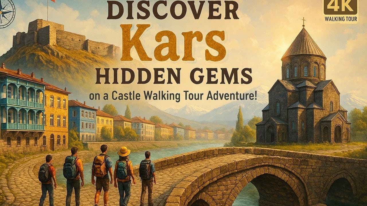
Plan Kars around the UNESCO-listed ruins of Ani, the castle, the Russian-era stone centre, frozen Lake Cildir and Sarikamis.
Walk this route
Be Teleported to the Middle Ages! Fascinating 4K Walking Tour in 1000-Year-Old Kars Castle
Watch the 4K walkPlaces on the map
17 pinsNumbers match the order in the article. Tap a pin for directions.
Kars: a Russian-planned stone city next to an abandoned medieval capital
Kars does not look like the rest of Turkey, and there is a specific reason for that. From 1878 to 1918 the city was under Russian rule, and during those forty years the centre was redrawn from scratch: wide streets meeting at right angles, numbered blocks, and buildings of dark volcanic stone with thick walls, high ceilings and iron balconies. The result is a town centre that has more in common with a Baltic port than with Anatolia. You will not get lost in central Kars, because it was not designed to let you. That fact tells you most of what you need to know about the place before you have seen a single monument.
The city sits at roughly 1,750 metres on a treeless, windswept plateau. Forty-five kilometres east, on the lip of a gorge cut by the Arpaçay river, sits Ani: the medieval Armenian capital, once one of the largest cities in the region, abandoned after Mongol raids and earthquakes, and now a scatter of churches and walls on empty grassland right against the Turkish-Armenian border. A trip to Kars moves between those two poles: a nineteenth-century city that was planned and finished, and an eleventh-century city that was finished and then let go. Seeing both in one day tends to quiet people down.
This is not a destination for everyone. Nobody comes to Kars for beaches or easy walking. You come for history, architecture and emptiness. Winter temperatures can reach minus 30C, and that is a planning input, not a figure of speech. The most common mistake starts right there: people arrive on the Eastern Express, stay two days, spend one of them photographing snow from the train platform, give Ani ninety minutes, and leave. Ninety minutes is not a visit to Ani. That plateau needs half a day, and if you do not give it half a day, what you will have seen is a car park with a view.
Quick answer
Kars pairs a Russian-planned stone city centre with Ani, an abandoned medieval capital on the border, and it needs at least three full days with half a day reserved for Ani alone.
- The centre is walkable: the castle, Kümbet Mosque, the stone bridge and the grid streets fit into one morning.
- You need a car for Ani, Çıldır and Sarıkamış. Public transport will not make those work as an itinerary.
- Winter is the real season: ice and sledges on Çıldır, snow at Sarıkamış, a white Ani plateau. The price is serious cold and roads that close.
- Ani is a border zone and the rules change. Verify current conditions officially before you go.
Places to see in Kars
1. Kars Castle
The castle stands on a rocky bluff north of the centre, above the point where the Kars river cuts through. The reason to climb it is not really the fortress itself but what you see from the top: the grid plan of the centre resolves in a single glance. From street level it is hard to grasp how rigidly the avenues cross at right angles, how the stone buildings line up at a matching height, how thoroughly the whole thing was drawn at a desk. From above, the argument ends. The structure was destroyed and rebuilt many times, so most of what stands today is late, and the interior has been restored. The walk up is short but steep, and the wind at the top is harsh in every season, so bring a layer even in July. In winter the stones ice over, and if your soles are smooth do not push it. Come early: the morning light falls across the centre and you get the hill to yourself. Opening hours can change, so verify officially.
2. Kümbet Mosque
At the foot of the castle sits a tenth-century Bagratid building, originally constructed as the Church of the Holy Apostles. It is a domed, round-bodied structure with twelve external faces. Carved reliefs of the apostles are still legible on the outer wall, and if you look long enough the eroded faces resolve. This one building summarises the last thousand years of Kars on its own: built as a church, converted to a mosque under the Ottomans, turned into a Russian Orthodox church during Russian rule, handed back, used as a museum for a stretch, and today a working mosque again. You do not need a history book to understand how often this city changed hands. The walls have already told you. Remember that it is an active place of worship: avoid prayer times, keep quiet inside, and women should cover their hair. It sits a few hundred metres from the castle and belongs in the same walk.
3. Kars Stone Bridge
Just downhill from Kümbet Mosque, crossing the Kars river, stands a low three-arched Ottoman stone bridge. I am not going to oversell this as a destination: it is a ten-minute stop. But the castle, the church and the bridge all cluster around the same mouth of the valley, which makes them a single walk, and the bridge is where that walk pays off. From below, the rock bluff, the castle wall and the church body stack into one frame. This is the most honest photograph of the city, and it is not taken from the avenues downtown. The water partly freezes in winter and thins out badly by late summer. The surroundings were tidied up in recent years and there is a riverside path. Keep it short, then walk back toward the centre on foot: the descent drops you straight into the Russian-era quarter, which is the next stop anyway.
4. Russian-era Kars: Faikbey Caddesi and around
This is a district, not a building, so the map pin is an approximate centre rather than a specific address. Between 1878 and 1918 the Russian administration planned the centre from nothing, and this is what makes Kars Kars today. Walk Faikbey Caddesi and the avenues running parallel to it: two and three storey buildings in dark cut stone, symmetrical windows, triangular pediments, walls built for a climate that kills. Some have been restored, some have been left to rot, and some have a phone shop on the ground floor. Do not expect a curated open-air museum. This is a working town centre, and that is exactly why it reads as real. Look at the dates above the doors, the ironwork on the balconies, the carved window surrounds. You do not need a guide here, you need time: give it two hours, walk without a plan, and stop at the intersections to see how far the street runs dead straight. No other city centre in Anatolia behaves this way.
5. Kars Museum
East of the centre, over toward the station. It is a small museum and it will not eat two hours, but get the order right and it changes the rest of your trip: come here before you go to Ani, not after. The archaeological layers of the region are here, along with stonework, inscriptions and architectural fragments brought in from Ani itself. Only after seeing these can you picture what once covered the bare walls out on the plateau. The ethnographic section holds local textiles, domestic objects and material from the region's mixed population. Outside there are stone pieces on display and an old locomotive. Not every information panel is bilingual, so bring patience or a reader of Turkish. Days and hours can change, and Monday closure in particular is worth checking, so verify officially. In winter it is heated, which on certain days is reason enough on its own.
6. Ani
Forty-five kilometres east of the centre, on the edge of the Arpaçay gorge. Ani was the capital of the medieval Armenian kingdom, a large and crowded city on the trade routes, abandoned after Mongol raids and earthquakes and never rebuilt. It is now a UNESCO World Heritage Site. What you are looking at is not a handful of churches, it is the footprint of a city: the entrance walls run long, the inner plateau is wide, the buildings sit hundreds of metres apart, and between them there is nothing at all except grass and wind. That emptiness is the actual experience of Ani. Standing in it and doing the arithmetic on how many thousands of people once lived here is genuinely unsettling. The gorge is also the Turkish-Armenian border. Give it half a day, carry at least two litres of water per person, and accept that there is no shade and the wind never stops. Border-zone rules and entry conditions change: verify officially before you go.
7. Ani Cathedral (Fethiye Mosque)
The largest standing structure on the plateau, and if you had to explain Ani through a single building, this is it. Begun in the late tenth century and completed in the early eleventh. The dome and the drum that carried it collapsed long ago, so when you step inside there is sky above your head, but the walls, the piers and the pointed arches are still there. Pay attention to those arches: they were built here well before Gothic architecture in Europe adopted the same form, which is precisely why architectural historians keep arguing about this building. After the city changed hands it served for a period as the Fethiye Mosque, and both names are still in use. The scale and acoustics inside are far beyond what the exterior suggests. Go in, stand still, stop talking, wait a minute. Earthquake damage is severe and the surroundings are sometimes fenced off for safety. Do not touch the walls or climb on the stones.
8. Menüçehr Mosque
On the western lip of the plateau, directly above the gorge, identifiable from a distance by its minaret. It dates to the eleventh century and is often described as one of the earliest Seljuk-period mosques in Anatolia, though both the construction date and the patron are academically disputed. Be sceptical of any guide who tells you a tidy story about it. The geometric stonework on the ceiling and the banded coloured stone are still visible, and interior detail at this quality is rare at Ani now. But the real reason to come is the position. Because the building sits right on the edge, it is the most open viewpoint in Ani. The Arpaçay runs below you and the opposite slope is Armenia. Seeing the border as a stream bed rather than a line on a map is the thing people remember longest. There is no railing along much of the edge and it is a genuine drop, so watch children closely here. Border-zone photography rules apply.
9. Bagnayr Monastery
A ruined monastery on the road to Ani, absorbed into the village of Kozluca. Do not expect a signpost, a car park, a ticket desk or a cafe, because none of them exist. The remains are tangled into the fabric of the village, parts of the complex served as barns and storage for a long time, and what you see today is neglected. It is still worth the stop, because after the theatrical emptiness of Ani this shows you the ordinary version of what happened across the region: not a monument, just a forgotten building. Stonework and arch detail survive on the standing sections. Manoeuvring a car inside the village is awkward and the track turns to mud in rain. You are in a place where people live: do not walk into private yards, do not force residents into your photographs, and greet the people you pass. It is a thirty-minute stop and it slots easily into the drive back from Ani.
10. Lake Çıldır
About eighty kilometres north of the centre at an altitude of 1,950 metres. In winter the surface freezes solid, and Çıldır's entire reputation rests on that: horse-drawn sledges on the ice, ice fishing in the Eskimo style, nets hauled up through cut holes. If you want to see this, the months are January and February. December and March are not reliable, because ice thickness varies from year to year. When the ice is too thin the sledges do not run, and nobody will volunteer this over the phone, so ask about current conditions before you commit to the drive. If you come in summer, let us be honest: it is a calm, pleasant, entirely ordinary lakeshore at the end of a long road. Winter clothing here is not negotiable. Out on the ice the wind chill can reach minus 30C, so do not step out without thermal base layers, waterproof boots and gloves. Sledge and tour prices vary by negotiation, so agree first.
11. Lake Aygır
A small volcanic crater lake in Susuz district. You can detour to it on the way to Çıldır, and there are no crowds. On most days there is nobody at all. The water is dark and clear, the surrounding plateau is bare, and there is no cafe, no toilet and no marked trail. The thing to know before you go is the road: the last section is unpaved, a low-clearance car will struggle in rain or snow, and in winter it is usually unreachable. On a dry summer day an ordinary car is fine if you drive slowly. What you get in return is a stretch of water in Kars province where you can sit without meeting another person. Bring food and water, and carry your rubbish out. People do fish here; for permits and season rules, verify officially. An hour is enough.
12. Beşkilise
A cluster of ruined churches on the Digor road, and the Turkish name means exactly that: five churches. Set your expectations now. This is not a managed archaeological site, it is a scatter of ruins in open country. Signage is minimal or absent, there is no car park, no ticket and no warden. Some of the structures have collapsed badly, others still stand with their arches intact. Whether it is worth the trip depends on you: if you have seen Ani and want to know what else is out there, yes; if you are trying to fit a lot into one day, no. There are dozens of ruins like this between Kars and Digor and not one of them is set up for tourism. Past the point where the car stops there is a short walk across rough ground and long grass, so cover your legs in snake season. Save the coordinates before you leave, because there may be nobody around to ask.
13. Mren Cathedral
In Digor district, very close to the border, a seventh-century cathedral ruin. It is one of the earliest structures in the region, older in architectural terms than anything at Ani. It stands on the edge of a valley, heavily damaged but still impressive in scale. I have to be straight with you about putting this on a list: access conditions vary. The building sits near the border line, and entry to the area may require permission in some periods and be entirely straightforward in others. Verify current conditions officially before setting out, and asking at the local gendarmerie post is the practical route. Driving a hundred kilometres and turning back is a thing that actually happens here. If you do get in, know that you will be alone, there are no facilities, and your phone may not have signal. Bring water, fuel and patience. Budget half a day.
14. Çengilli Church
A church standing inside a high village in Kağızman district. It is the hardest stop on this list to reach and that should not be underestimated: the road up is narrow, steep and switchbacked, and it is usually closed in winter. In spring, snowmelt tears it up. Do not plan this outside summer and early autumn. The building itself is largely intact with visible stonework, but the altitude of the surrounding plateau is what defines the trip: you are not coming to see a building, you are coming to get to a place. You will find somewhere to drink tea in the village, but do not look for a restaurant. Do not trust satellite navigation blindly on the approach, ask in the village. The round trip from Kağızman will take half your day, and do not try to compress it into the same day as Sarıkamış. Both deserve their own.
15. Sarıkamış
A town in a Scots pine forest about fifty-five kilometres southwest of the centre. It was founded as a garrison town during the Russian period and you can still read that today: the old military buildings, the officers' club, the railway station and its staff housing all survive in the same stone architecture. Coming here after seeing central Kars completes that story. The town is also the name of the Sarıkamış campaign of the winter of 1914-15. A very large number of Ottoman soldiers died in that campaign, and most of them died of cold rather than fighting. It is worth being restrained about this: sources that argue over numbers contradict each other, and this place is first and foremost a graveyard. Walk in the forest and think about what this country is like from late November to April, and the rest does not need saying. The town is small and a few hours will cover it.
16. Sarıkamış ski resort
On the Cıbıltepe slope right beside the town. Two things set this apart from Turkey's other ski areas: the snow is dry, and the runs cut through Scots pine forest. Dry snow means low humidity keeps the crystals from clumping, which is what skiers are praising when they call it crystal snow, and it is genuinely not the same substance as the wet snow at resorts closer to the Black Sea or the Mediterranean. The season is long, typically expected to run from December to late March, but opening and closing dates shift with snowfall. The resort is not on the scale of the big western Turkish centres and accommodation is limited, so book early for weekends and the school half-term break. Equipment can be rented. The number of runs, which lifts are actually operating, and prices all change from season to season, so verify officially. Even if you do not ski, come for a walk in the forest.
17. Sarıkamış-Allahuekber Mountains National Park
The national park begins southeast of the town and covers Scots pine forest and high ridges. It is both a natural and a historical protected area: the ground where the winter of 1914-15 played out lies within these boundaries, and the memorial site is here. In summer people come for forest walking, wildlife and the high pasture, and your odds of seeing deer or wild boar along the road are real. In winter it is a different place entirely, and you should not walk into the forest alone: altitude climbs fast, visibility drops to nothing in a blizzard, and losing your bearings in that terrain has serious consequences. Go with a guided tour, or at minimum with someone local. Marked trails inside the park are limited. Commemoration events are held every January and the area is crowded on those days, with accommodation hard to find. For entry conditions and the event calendar, verify officially.
When to go
The honest answer is that Kars has two seasons, winter and summer, and which one you pick depends entirely on what you came to see.
Winter runs from November to late March and it is not a joke. Temperatures can reach minus 30C, and sitting at minus 20C all night is an unremarkable December. Despite that, winter is the real season here. Çıldır is only Çıldır when it is frozen, the snow at Sarıkamış only exists in winter, and a white Ani plateau is a different experience altogether, because emptiness looks emptier in snow. If you come in winter, come equipped: thermal base layer, thick mid layer, windproof shell, waterproof boots with grip, gloves, hat, neck gaiter. Wool socks, not cotton. Roads close, flights get cancelled, so stay flexible and build a spare day into your plan.
Summer, from late June to early September, is short and excellent. The plateau is green, days run around 25C, evenings are cool enough for a jacket. This is the only window in which visiting Ani is comfortable, the church ruins around Digor and Kağızman are reachable, and the track to Lake Aygır is passable. The only cost is that Çıldır becomes unremarkable and Sarıkamış has no snow. Spring and autumn are brief transitions: May is muddy, October is lovely but unpredictable. November and April give you the worst of both, no snow but plenty of cold.
Getting there
Flying is the practical option. Kars Harakani Airport is about fifteen kilometres from the centre, with scheduled flights from Istanbul and Ankara. Winter cancellations and delays are routine, so do not schedule your return flight immediately before something that matters.
The Eastern Express (Doğu Ekspresi) is a roughly twenty-four hour train from Ankara to Kars, and in recent years the journey itself has become the destination. The scenery is genuinely good, particularly after Erzincan. But know two things: sleeper tickets sell out the day they are released, and winter travel needs planning months ahead. The Touristic Eastern Express and the regular Eastern Express are different services with different prices and comfort levels. Schedules, ticket release dates and fares change, so verify officially. And do not compress Kars into two days just because you took the train. That is the original mistake.
Renting a car is the backbone of a Kars trip. Ani, Çıldır, Digor, Kağızman and Sarıkamış cannot be covered efficiently by public transport. There are rental offices at the airport and in the centre. Winter tyres are a legal requirement in winter and carrying chains is sensible, so inspect the tyres yourself at pickup. You do not need a car for the centre, which is walkable. Minibuses and shared tours exist for Ani, but the hours are restrictive and they generally will not leave you enough time on site.
What to eat
Kars is a cheese route, and that is not a marketing line. Kars kaşar is one of Turkey's best-known cheeses, and the aged versions you find here are not even related to the plastic-wrapped kaşar in a supermarket. The village of Boğatepe and the dairies around it are the centre of production, and visiting a dairy to see how the cheese matures and to taste it through its stages is one of the most concrete memories you will take out of Kars. Gruyère-style cheese is made here too.
Goose (kaz) is the region's signature dish and it is seasonal work: the birds are slaughtered as winter comes on, then dried and salted, and usually served over bulgur pilaf. Fresh goose is hard to find in summer, so what you meet is the dried version, and the flavour is intense. Goose is not a meat everyone enjoys and it is fatty. If it is your first time, share a portion.
Kars honey is the other signature, and the real event is breakfast: honey served alongside kaymak, clotted cream. Do that once and your standard for breakfast is permanently raised. A Kars breakfast is not just honey and kaymak either, it runs long through a spread of cheeses, butter and village bread. Give your morning to it and you will skip lunch anyway. Ask about local dishes like piti, evelik and hangel as well. I am not going to name specific restaurants, because businesses change. Ask in town, everyone has an opinion.
How to see Ani
Give Ani half a day. That is the one rigid rule in this guide. The site is enormous and the distances between structures run into hundreds of metres. Walking from the entrance gate to the furthest point and back takes an hour even without stopping. You do not tour Ani, you walk it.
The plateau is bare. There are no trees, no shade, no shelter, and the wind blows in every season. In summer the midday sun is brutal: wear a hat, use sunscreen, and carry at least two litres of water per person, because buying water on site is not always possible. In winter the wind makes it feel far colder than the reading, so cover your face. The ground is uneven and stony, so wear proper shoes and not sandals. Wheelchair access to most of the site is not practical.
A suggested order: enter through the walls, head east toward the cathedral first, work across to the buildings on the gorge edge, and save the Menüçehr Mosque and the valley view for last. The best light is early morning and late afternoon. Midday sun flattens the stone and your photographs will look flat with it.
Ani is a border zone. The far side of the gorge is Armenia and the area is militarily sensitive. Rules on photography and drones, opening hours, and access to certain sections change from time to time. Do not even consider flying a drone. Follow the posted signs and any instruction from staff to the letter. Check current conditions officially before your visit, because the rules here change faster than the blog posts describing them.
FAQ
**How many days do I need for Kars?**
At least three full days. One for the centre and the museum, one for Ani and Bagnayr, one for Çıldır or Sarıkamış. With four you can add the church ruins around Digor or Kağızman. Two days is not enough, and underestimating this is the most common planning error people make here.
**Is going in winter sensible, or just miserable?**
Sensible, if you are prepared. The ice and sledges at Çıldır, the snow at Sarıkamış and a white Ani plateau exist only in winter. In exchange you accept serious cold, roads that can close and flights that can cancel. Come with the right clothing and a spare day in the schedule. Come with the wrong clothing and Kars in winter is just punishment.
**Can I do this without a car?**
The centre, yes. The rest, no. The castle, Kümbet Mosque, the stone bridge, the Russian-era streets and the museum are all comfortably walkable. Ani, Çıldır, Sarıkamış, Digor and Kağızman need a car or a tour. There is a minibus option to Ani, but it will not leave you enough time on the plateau.
**Do I need a special permit for Ani?**
For a standard visit you generally do not need separate permission, as the site is open to visitors. But it is a border zone and the rules can change, and the situation may be different at points closer to the line such as Mren in Digor. Verify current conditions officially before you set out.
**When does Lake Çıldır freeze, and are the sledges guaranteed?**
Ice is usually thick enough in January and February, but this varies year to year and nothing is guaranteed. December and March are risky. Sledge tours do not run when the ice is unsuitable. Ask about current ice conditions before you go, rather than driving a hundred and sixty kilometre round trip for nothing.
**What should I buy in Kars?**
Cheese and honey. Kars kaşar and the local gruyère bought at a dairy are a different product from the supermarket version, so take the vacuum-sealed option and check it into the hold. Kars honey is heavy but it is the real thing. If you want to take dried goose home, think carefully about the smell and how you will pack it, because everything else in your suitcase will end up smelling like it.
Planning questions
What does this Kars guide cover?
Plan Kars around the UNESCO-listed ruins of Ani, the castle, the Russian-era stone centre, frozen Lake Cildir and Sarikamis.
Can I watch a 4K walking tour of Kars?
Yes. The page links to Travel Walk Tours films so you can preview the Kars route on a big screen before you go.
How should I use this page to plan?
Read the quick answer first, skim the route notes, then compare street texture, timing, and nearby guides through the linked city page and walking films.